Fortunately, everything is available from the beginning of the story and how to assess the vulnerability of the country and the Tehran earthquake management plan. Of course, I am not a pure seismologist and geologist, and I am a lecturer and professor of earthquake engineering and crisis management (if you agree!) but for 35 years I have worked closely with the world’s finest seismologists. And in the country, and I learned a lot from them and about the nature of earthquakes and from them, there was not a day that I did not study this phenomenon! From all angles of old and new sciences, especially from the angle of engineering and the resistance of hard materials such as the Zagros mountain range (making nails according to the Holy Qur’an) and cracked materials on steel, semi-steel and impact – flexible substrates. (molten materials, elastic substrates) differ in the transfer of catalysts from one side to the other.) etc.! Something that pure seismologists don’t care about or don’t care about!?
In this regard, and with Hormozgan’s gradual soothing, as I said before, the interview is attached here:
Thank God it actually happened and he’s calming down (even in potential agony for a while). But I see the region of Iran from the Persian Gulf upwards, i.e., Kerman, Fars, Kohjiluyeh, Boyar Ahmad, Chahar Mahal and Bakhtiari to the west and up to the center and Tehran, more tense than others. The whole of Iran is always under the pressure of earthquakes, but because of the long earthquakes return, memories are forgotten.
In this regard, the period of return of many large earthquakes passed in these regions, and due to the impulsion of the Zagros faults, from their end, which is Hormozgan, to the top, and finally to Tehran, where an earthquake of more than 7 Richter magnitude occurred. In 1830, 190 years ago, with a return period of 158 years. It becomes more dangerous for an earthquake of 7 and above, i.e. a possible earthquake in Tehran. There are also extensive research cases in this field, which I will publish at the appropriate time, God willing. I want to confirm this again!?
I think this is all a miscalculation! The entire region of Iran, the range between the two yellow lines on the map of Iran is defined as follows:
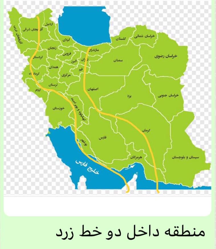
The recent earthquakes in Iran
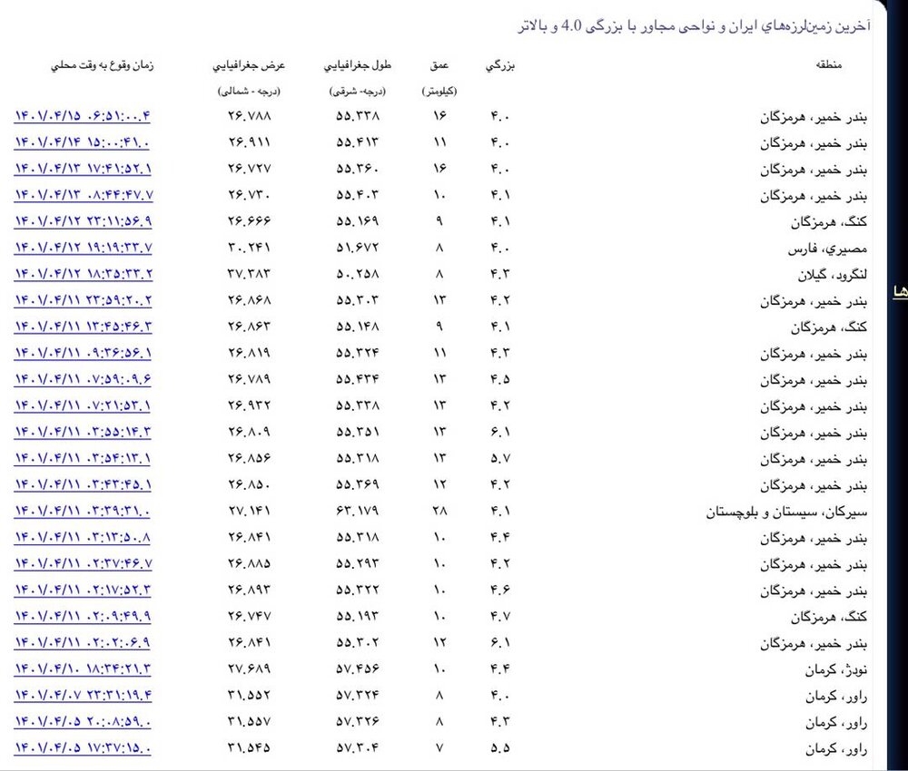
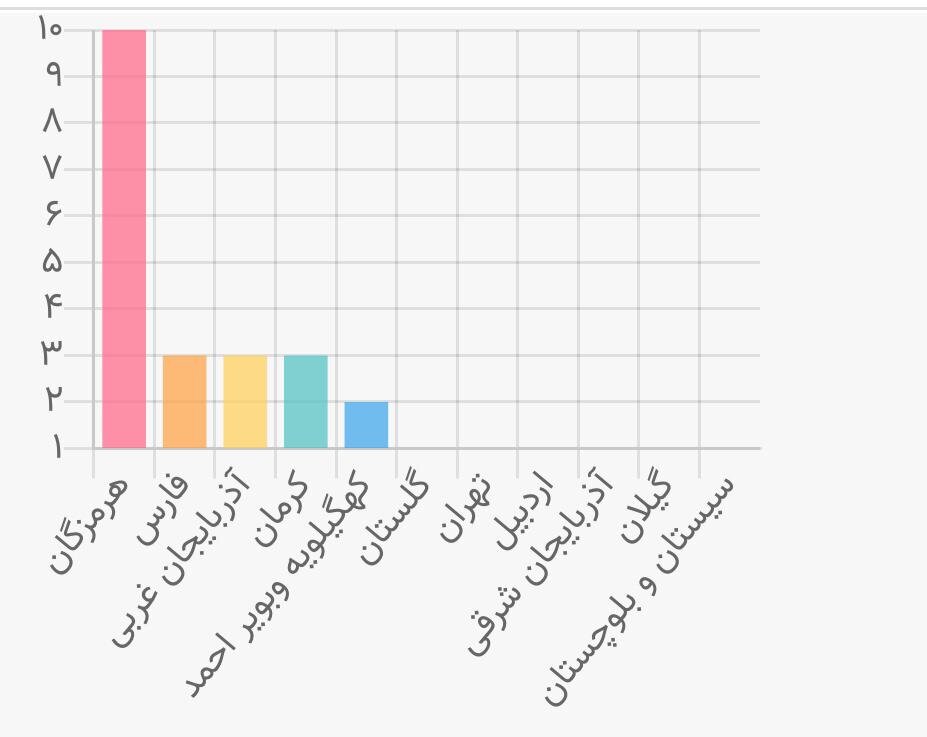
Distribution of recent earthquakes in the country

Recent earthquake statistics in the country and affected provinces include two earthquakes last night in Fasham, Tehran and Bandar Khamer.
earthquake northeast of tehran
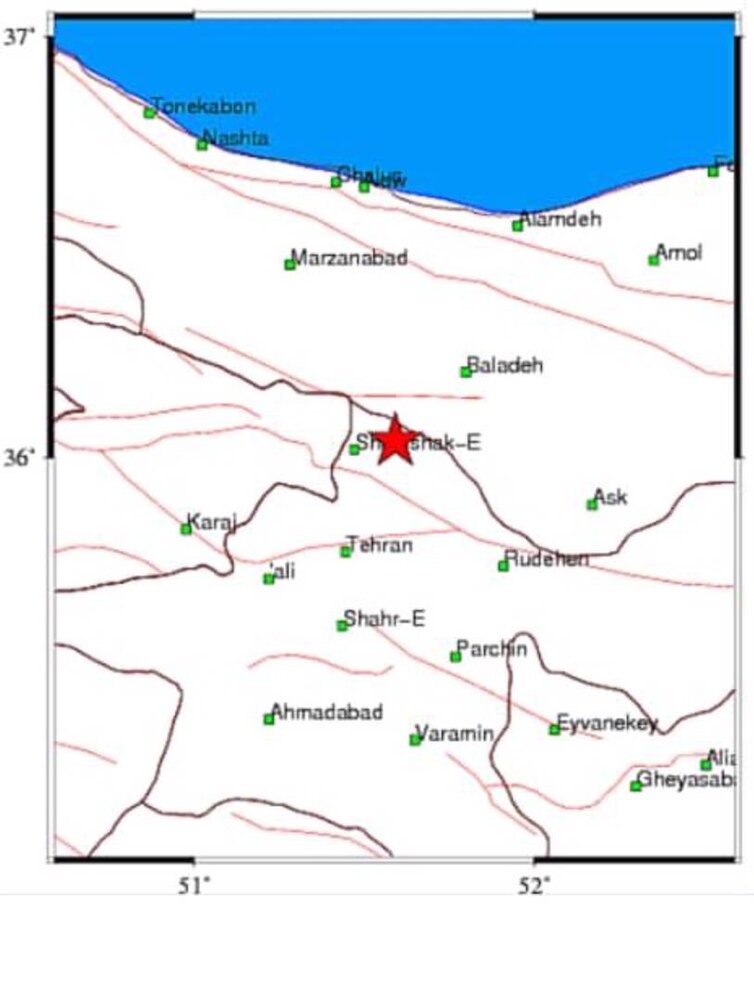
Zagros region from Hormozgan to the neighboring country
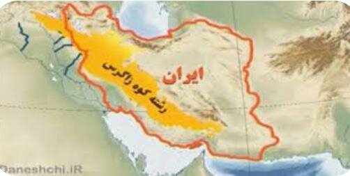
I have always written that I told common sense to understand wisely, this is the first time I have said wisely, you must understand common sense and a little real!
*Professor of National Model, Structural Engineering, Earthquake and Crisis Management, founder of Retrofitting and Crisis Management in Iran and founder of the Jabdegan Shahr Association in the country


